UN
63 Folly Lane
£ 122,500
Description
We don't have a Description for this property.
- Bedrooms
- 2
- Bathrooms
- 0
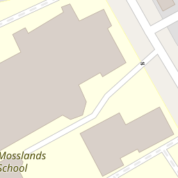

Leaflet © OpenStreetMap contributors
The heatmap indicates the level of crime in the area. The color of the heatmap indicates the crime severity and recency.
Metrics Year-on-Year
- Average area value
- 297,608.00 £Increased by 16.61 %
- Average area rental value
- 1,039.00 £/moDecreased by 10.04 %
- Est rental Yield
- 4.19 %Decreased by 22.84 %
- Crime Rate
- 14.00 %Unchanged by 0.00 %
from 255,219.00 £
from 1,155.00 £/mo
from 5.43 %
from 14.00 %
Nearby Schools
| Name | Type | Ofsted | Distance |
|---|---|---|---|
| The Mosslands School | Community School | Requires improvement | 0.23 KM |
| St Mary'S Catholic College, A Voluntary Academy | Academy Sponsor Led | Requires improvement | 0.41 KM |
| St George'S Primary School | Community School | Good | 0.44 KM |
| Weatherhead High School | Academy Converter | Outstanding | 1.07 KM |
| Greenleas Primary School | Community School | Good | 1.48 KM |
Images
Nearby Streets
| Name | Average Price | Average Sqft | Distance |
|---|---|---|---|
| Somerset Road | £ 0 | 0 | 0.00 KM |
| Hillside Road | £ 0 | 0 | 0.00 KM |
| Church Hill | £ 0 | 0 | 0.00 KM |
| Westbourne Road | £ 0 | 0 | 0.00 KM |
| Wood Lane | £ 0 | 0 | 0.00 KM |
Nearby Transport
| Name | NLC | TLC | Distance |
|---|---|---|---|
| Wallasey Village | 2265 | WLV | 0.54 KM |
| Wallasey Grove Road | 2154 | WLG | 1.01 KM |
| Bidston | 2136 | BID | 1.92 KM |
| Birkenhead North | 2145 | BKN | 1.94 KM |
| New Brighton | 2152 | NBN | 2.70 KM |
Nearby Listings
| Address | Price | Type | Score | Distance |
|---|---|---|---|---|
| Beaufort Drive, Wallasey, Wirral | £ 220,000 | BUY | Unknown | 0.22 KM |
| Mosslands Drive, Wallasey | £ 215,000 | BUY | 6 / 10 | 0.23 KM |
| Wallasey Village, Wallasey, Wirral | £ 75,000 | BUY | Unknown | 0.24 KM |
| School Lane, Wallasey, Wirral | £ 275,000 | BUY | 8 / 10 | 0.24 KM |
| Somerset Road, Wallasey, Wirral | £ 280,000 | BUY | 8 / 10 | 0.28 KM |
Nearby Properties
| Address | Price | Distance |
|---|---|---|
| 63 Folly Lane | £ 122,500 | 0.00 KM |
| 54 Folly Lane | £ 128,000 | 0.00 KM |
| 60 Folly Lane | £ 100,000 | 0.00 KM |
| 48 Folly Lane | £ 126,000 | 0.00 KM |
| 69 Folly Lane | £ 105,000 | 0.00 KM |